Kerala offers dozens of spectacular experiences-make sure you check them out while driving around the state with the road map of Kerala.

Roads in Kerala are often compared to the arteries of human beings by guests who are visiting Kerala as a well connected network of roads help in fast and comfortable travel to various tourist places in Kerala like Cochin, Munnar, Alleppey, Kanyakumari, Kumarakom, Thekkady, Alleppy, Wayanad, Kovalam, etc. Kerala is very well connected with a good network of roads and the villages of Kerala are also easily accessible by good roadways and there is a planned Road Map of Kerala. The road route map of Kerala can make your road trip in Kerala, a delightful assault to the senses-the colors, the smiles, and the landscapes are bound to leave the traveler in you reeling with joy.
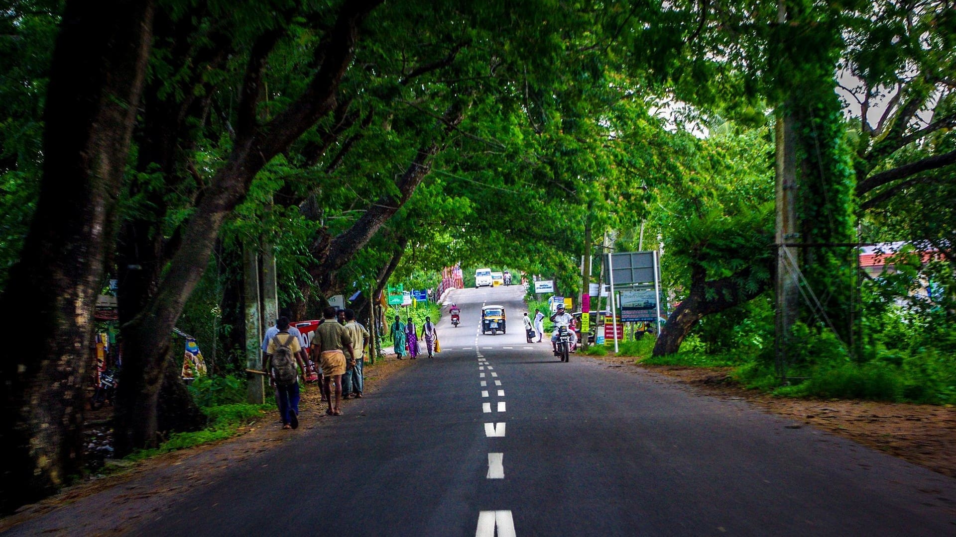
The beauty of Kerala’s roads lies not only in their quality but also in the breathtaking sights they offer. The state’s highways are often compared to the arteries of a human body, carrying life and vibrancy to every corner of the state. These well-maintained roads connect various tourist hotspots, making Kerala a road-tripper’s paradise.
Drive through the well-developed road network system of Kerala that plays an important role in the economic, industrial, and commercial development of the country through the Kerala road route map.
The Kerala state highway map made the journey smooth peppered with great roads and amazing panoramas. There are eight national highways in the state of Kerala with the major highways NH 17, NH 47, and NH 49 connecting other parts of the state. There are 72 state highways in Kerala linking district headquarters and important towns within the state and connecting them with national highways or Highways of the neighboring states.
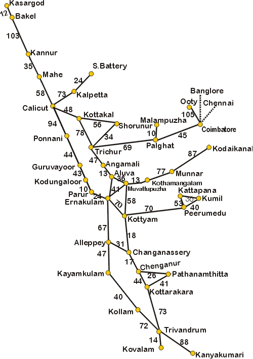
Detailed Road Map of Kerala
Learn about the internal road routes of the state which connect headquarters, important towns in the state, and the national highways through the Kerala state highway map.
The detailed Road Map of Kerala with distances between major places and shown in the below map of Kerala can be used to calculate the distance between different destinations in Kerala. If you want to get to the tourist places in Munnar from Ernakulam you can calculate the distance between Ernakulam-> Muvattupuzha -> Kothamangalam -> Munnar which is equivalent to 41+13+77 = 131 kilometers which is the distance to Munnar from Kochi.

Kerala has 145,704 km of roads which consists of 4.2% of India’s total roadways. The road density of Kerala is about four times the national average, reflecting the high population density of the state. India’s national highway network includes the highway of Kerala-with an overall 1,524 km, which is 2.6% of the total road network in India.
Any traveler should always have a thorough route map with them. It not only assists in navigating through unknown territory but also in making the best travel arrangements. A decent road map of Kerala shows exact distances between points, the state of the roads, and the best routes for avoiding traffic. This information is essential for making travel arrangements, determining travel times, and making sure your trip will go well and without incident.
Enjoy a road trip through the beautiful sceneries of Kerala through Kerala Road Route Map that facilitates easy travel in the state.
Conclusion
In this guide, we’ve covered the highlights of planning a road trip to Kerala, from identifying key destinations and mapping out your route to understanding road conditions and navigating through major cities. We’ve also provided insights into exploring offbeat routes and shared important safety tips and emergency contacts. Remember, a well-planned journey not only ensures smooth travel but also enhances your overall experience.

Hi George, me and my wife ( 59 & 52 ) like to visit Kerala by March 2nd week. We want to cover Thiruvananthapuram, Alleppey, Cochin, Guruvayur and finally Kotakkal for help purpose. Pls help us, how to plan our journey. Thank you.