The Highest Peaks in Kerala makes it one of the most famous holiday destinations for people around the world. Kerala is known as God’s own country as it is rich in brilliant natural beauty, which attracts tourists not only from India but also from all over the world Kerala has many highest peaks which a tourist must visit during a visit to Kerala. Below is a list of some of the famous peaks in Kerala that you should not miss on your next Kerala visit:
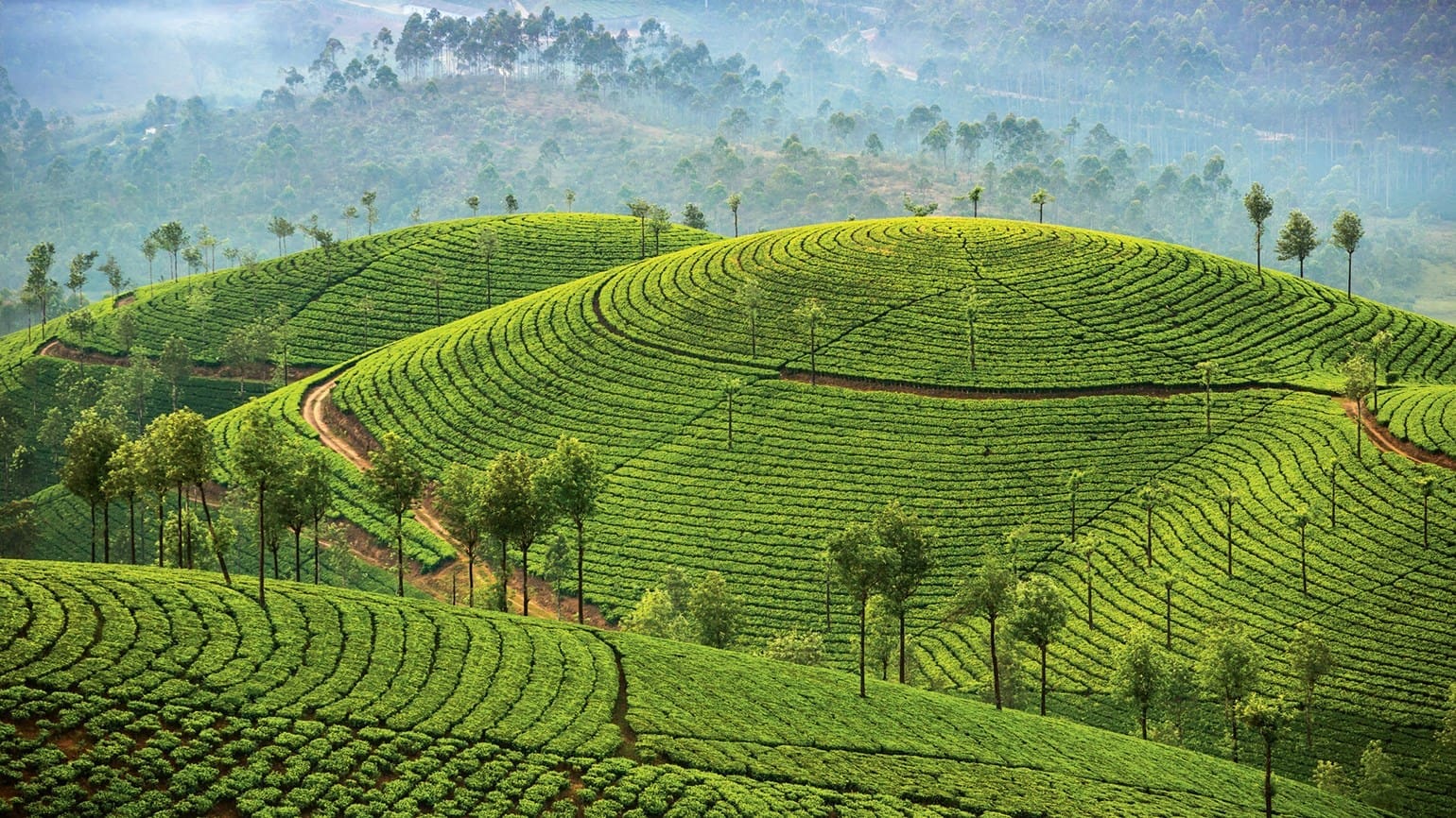
1. Anamudi Peak
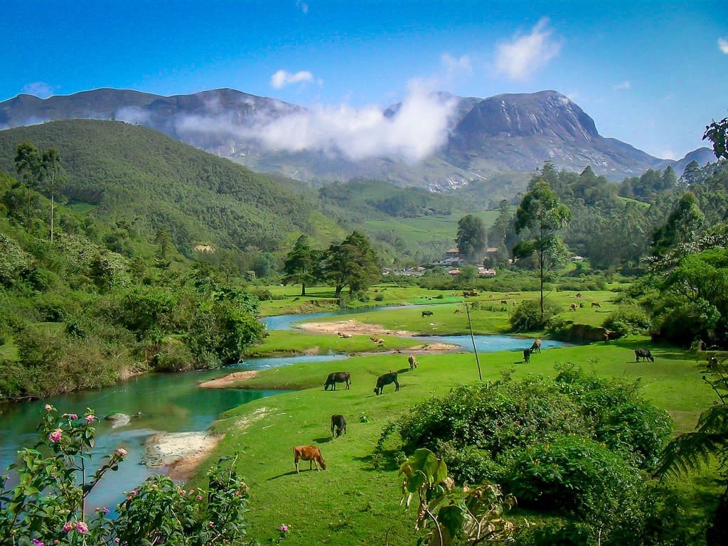
Anamudi or Anai Mudi is located in the Indian state of Kerala. It is the highest peak in the Western Ghats and South India, at an elevation of 2,695 metres, and a topographic prominence of 2,479 metres. Anamudi Peak is one of the prominent and highest peaks on the border of the Idukki district in Kerala and means elephant’s head. It is located in the Eravikulam National Park around 13 km from Munnar.
It is about 2695 meters or 8841 feet above sea level, which makes it the highest peak in southern India and is known as the Himalayas of South India. It is a charming, beautiful, lush green mountain, which has superb smooth slopes on its northern and southern side and rocky and rough on the eastern and western side. It is a paradise and inhibits the largest population of Asian elephants, Gaurs, and the Nilgiri Tahrs.
The mountain is covered with evergreen forests which are home to many different tree species like bamboos, black wood, teak trees, etc, and medicinal plants like Wintergreens, Impatiens, and Anaphalis. The area is abundant in very rare and different varieties of flora and fauna, birds and insects, who are on the verge of extinction. The most striking and unbelieving feature of this peak is the famous Neela kurini flowers a mass flowering plant, which blooms once in 12 years.
Neela Kurini grows in abundance in Eravikulam National Park which presents a magnificent view of the entire valley during the flowering season. It is not just a place with lush green valleys but many other attractions like gushing rivers, tea plantations, dense wildlife small hilltops, and widespread cultivation beautify this place even more.
The tropical climate of the area helps in the growth and development of various plant and insect species as well as their inhabitants. Anamudi Peak is well known for its trekking trails in Munnar. The peak can be reached by trekking after taking prior permission from Eravikulam National Park authorities. Trekking facilities are also available in Eravikulam National Park. Eravikulam National Park vising hours to this park are from 7:00 A.M to 6.00 P.M. The best time to visit the peak is November to May. It receives heavy rains during the monsoon while January to March is generally dry.
The Park remains closed during the monsoon. The expected temperature during winters is 18 degrees and 25 degrees in spring. Munnar is well connected by road from Kerala and the nearby state of Tamil Nadu. Road connectivity to Munnar from Ernakulam is great and takes around 25 minutes. The nearest Railway Station Aluva {kerala} is 120 Kms and Pollachi (Tamil Nadu) is 72 Kms. The nearest Airport Cochin (Kerala) is 143 Kms.
2. Meesapulimala
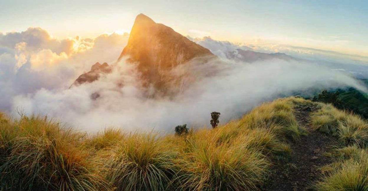
Meesapulimala is the second highest mountain peak in the Western Ghats in Idukki District in Kerala near the famous hill station Munnar. The mountain is about 2640 meters or 8661 feet above sea level. It is formed by eight hills like a moustache and interpreted as tiger moustache hill that is why it got its name Meesapulimala. This place has dense and rich rainforests, charming tea estates, and delightful streams because of which it has become the best and most popular adventurous trekking destination in Kerala.
ALSO SEE- Meesapulimala Trekking – Best Tips on Booking, Stay , Tour and Route
Trekking in this fascinating paradise via Rhoda Valley lined with hundreds of blooming Rhododendrons flowers through clouds, dense rain forests, eight hills, plenty of scenic spots and a glimpse of wildlife makes trekking a memorable experience. The scenic beauty of the mountain range can be experienced only by trekking to the top of the mountain and enjoy the scenic view of Munnar and its neighbouring Surianelli. For that one has to take a jeep to the base camp and then hike to the top of the mountain. The base camp is 24 Kms from Munnar via Mattupetty.
The journey to the base camp is difficult but exciting, Enroute one can see the Pandava Cave, where Pandavas are believed to have taken shelter during their exile. This cave also houses many small birds. The easier trek to the mountain from Rhoda Valley is 8 Kms long and trekkers have to travel a distance of 4 Kms in a jeep to Rhoda Valley at the starting point. Ascending and descending treks on this mountain are different. It is better to reach Munnar a day earlier and start the trek early in the morning and return before dusk.
ALSO SEE- 23 Best Places To Visit In Munnar, Kerala, With Map
Kerala Forest Development Corporation provides all necessary facilities for trekking and camping and an expert guide. One can reach the base camp from Munnar which is well connected with all the major cities in Southern India. The nearest railway station is in Theni, Tamil Nadu 60 Kms away. The nearest airport is Cochin International Airport is 125 km away. The best time to plan a trek to Meesapulimala is after the monsoon in the months of winter between October to February during this period entire region is reenergized after rains, the weather is comfortable and pleasant.
3. Agasthyakoodam
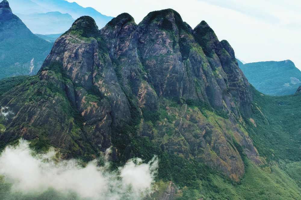
Agastya Mal Peak also referred to as Agastyaarkoodam peak is situated at a distance of 70 km from Trivandrum and is also one of the highest peaks in Kerala. It is covered with dense forest. The site is famous for two reasons-one being the best scenic spot and the other being the sacred place, Agasthyakoodam or Agastya Mala is named after one of the Saptrishis of Hindu Puranas who is believed to still exist as an illustrious being on the mountain top. His full-size statue has been installed there and it is a famous pilgrimage place for his devotees. The peak is open to pilgrims from January to mid-March.
ALSO SEE- Agasthyakoodam Trek Guide-Booking, Distance and Difficulty
Agasthyakoodam is a famous hill station, home to rare herbs of high medicinal value with diverse flora and fauna and a large number of wild lives like elephants Indian Gaurs, Leopards, Tiger, Sloth Bear, Sambar Deer, etc. Agasthyakoodam is the second highest hill station in Kerala and major rivers Thamirabarani and Karaman originate from here. The water of the Karaman river fulfils the needs of the city. It is a pleasure point for bird watchers and tourists can also come across almost fifty types of reptiles and more than a hundred types of butterflies.
The vehicle can go up to Bonacaud which is 50 km from Trivandrum. Trekking 28 Kms is the only means to reach Agasthyakoodam, which takes two days trekking through the forest. Trekking passes are issued by Kerala Forest Department from their office in Thiruvananthapuram. Trekkers have to follow the issued guidelines. Trekking is the best way to reach the cone-shaped peak and it takes one day to reach.
4. Ponmudi
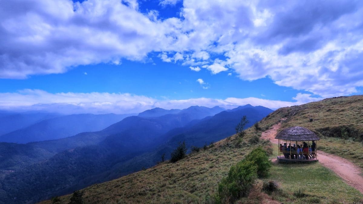
Ponmudi is another hill station in the neighbourhood of the main city Trivandrum. This hill station is situated at a distance of 55 km from Trivandrum. It is located at a height of 1100 meters or 3608 feet above sea level. It is connected with Trivandrum by road and the last stretch of 18 km of the road presents a picturesque view through mountains, tea garden slopes, rare flora, and fauna. It has a cool green atmosphere full of exotic mountain flowers, beautiful mountain flowers, and tiny streams. Travelling on this stretch is a thrilling experience as the driver has to make 22 sharp turns on hairpin turns.
ALSO SEE- Ponmudi hills – Best Places to Visit & Things to do
En route Ponmudi one can stop over to have a view of the Kallar River flowing parallel to the road in the opposite direction with attractive Meenmutty waterfalls a little distance ahead. In between, one can also have a view of lush green forests full of tropical vegetation from the eco point. The hill station has excellent trekking tracks. The other attractions near Ponmudi are Golden valley, Dear Park, Ponmudi falls, wood and stone cottages. The best time to visit Ponmudi is in winter between December to March.
5. Chembra Peak
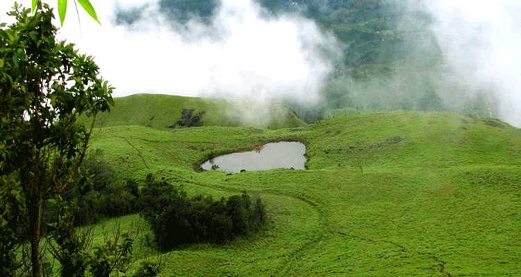
Chembra Peak is a mountain located near Meppadi town 8 km from the Wayanad district of Kerala adjoining Nilgiri hills in Tamil Nadu. It is the heights peak in Wayanad situated at a height of 2100 meters and 6890 ft above sea level. It is the perfect spot for those who admire natural beauty and love adventure. This peak is visible from everywhere in Wayanad. This place is ideal for trekkers and is accessible only on foot from Meppady.
The 3 Km long Trek to the peak is under the control of the Forest Department and it takes almost three to four hours to cover the trek. Overnight camping is not allowed, ascending and descending the peak is to be completed between 7.00 AM to 5.00 PM. Only those who reach the base camp and seek permission before 12.00 PM are allowed to trek.
ALSO SEE- Bangalore To Wayanad Trip-Best Routes With Maps
Prior Permission from the Forest Department at base camp Meppadi will have to be obtained for trekking to the peak, which also provides guides and trekking equipment for a fee. Trekking is through lush green tea plantations, waterfalls and slowly the scenic view of the valleys emerges.
One of the attractions of the trek is a splendid view of the heart-shaped pond on way to the peak. On reaching the peak one gets a wonderful view of the whole Wayanad. The place is known for its breathtaking views of rare and exotic species of flora and fauna and adjoining hills. The best time to visit Chembra Peak is between August to May. One can reach Meppadi town by private vehicle, buses etc from Wayanad.
6. Pambadum Shola
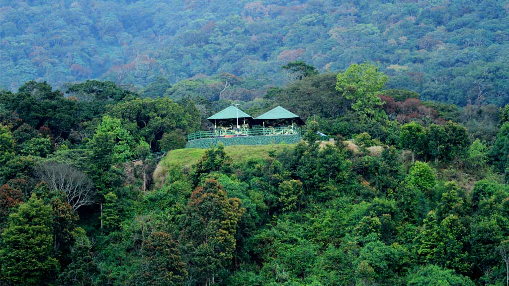
Pambadum Shola is situated at a height of 1886 meters and 6188 feet above sea level in the Idukki district and is also one of the highest peaks in Kerala. Pambadum Shola means the hill where snakes dance. The mountain peak offers a splendid and breath-taking view of its thick biodiverse flora and fauna, clear blue sky, and stretches of green meadows.
The mountain is surrounded by lush green surroundings abundant in medicinal herbs, wildlife, and rare bird species. Grassland patches known as Shola forests can be seen on this mountain above 1500 meters. The climate here is misty and cloudy throughout the year and the temperature drops to nearly 6C during winter.
Given the ecological, floral, faunal, geographical, and zoological significance of this area, Pambadum Shola was declared as a National Park by the Government of Kerala in 2003. It is the smallest National Park and is maintained Kerala Department of Forests and Wildlife. The best time to visit is from April to September. There are several trekking trails which can be trekked in 3 hours between 6.00 Am to 11.00 AM and 3.00 Pm to 6.00 PM.
The Park is located at a distance of 35 km from Munnar town and can be reached from Kochi (135Kms) and Kottayam (148 Kms) by Road. The Park is accessible from Cochin and Coimbatore airports located at about 170 Km and 160 Kms respectively.
7. Anginda Mudi
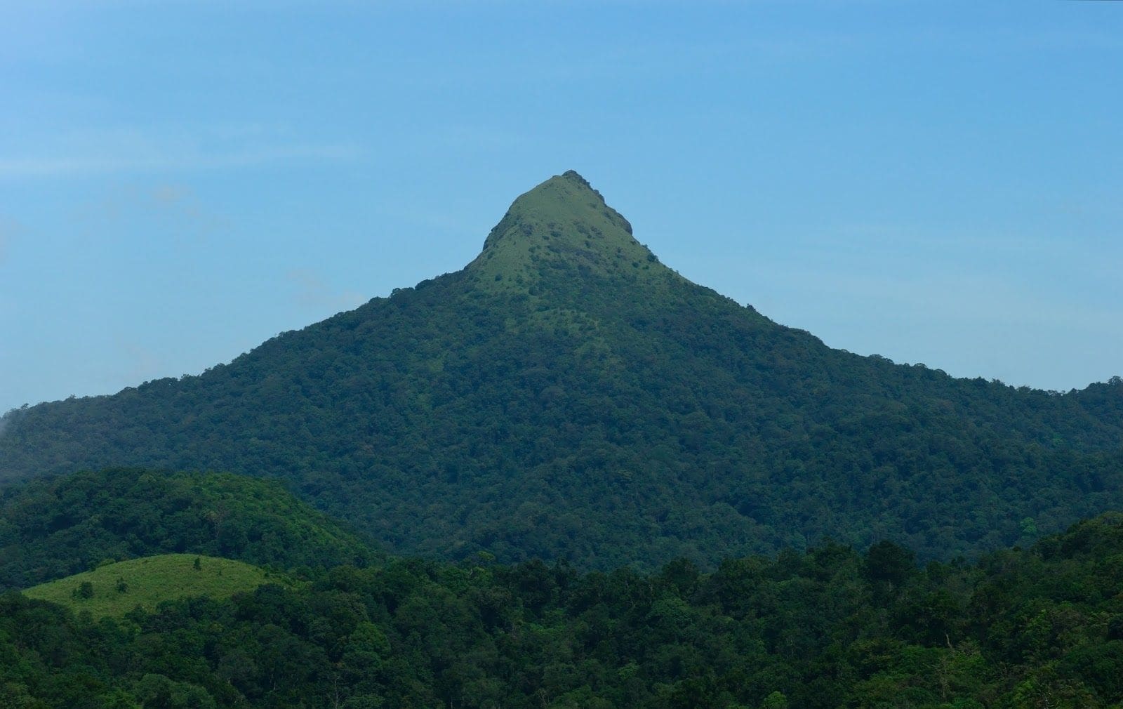
Angina is a mountain in the Nilgiri Hills in the Western Ghats is one of the highest peaks in Kerala. This peak is situated at a height of 2382 meters 7818 feet above sea level and is the height peak in silent valley national park in Palakkad district to the south of Sispara pass. It is famous for its remarkable scenic beauty. The slopes of the hill flourish with rare flora and fauna.
The main attraction here is the 30-meter-high observation tower at Sairandhri Visitors Centre which provides a clear view of Anginda Peak. It is a protected area and has been divided into three regions- the core area-the buffer area and the tourist area. Visitors are allowed only in the tourist area. Anginda Peak is an ideal place for trekking and wonderful trekking opportunity is provided to the tourists up to Anginda. This is interesting and an opportunity of experiencing beautiful scenic views.
8. Vellarimala
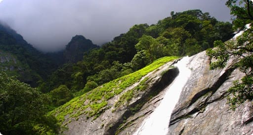
Vellarimala mountain range is situated at the tri-junction of Malappuram, Kozhikode, and Wayanad districts in Kerala. These hills are similar in bio-diversity to Nilgiri Hills. Vavul Mala is the tallest peak in this mountain range situated at a height of 2339 meters and 7673 feet above sea level and looks like a camel hump which makes it one of the highest peaks in Kerala. The attractive terrain, waterfalls, rivers, rocks, and cliffs attract tourists throughout the year.
This peak is a very popular destination for trekkers; however, prior permission from the forest department is required before undertaking trekking to the peak. This is one of the toughest treks in South India and can be a challenging nine-hour trek.
The trekking is through dense timberland frequented by elephants, tiny streams, and blooming wildflowers. The forests are so dense that one hardly gets a glimpse of the sky. There is no clearly defined trek to the peak one has to follow the animal trails, which are very prominent and thick. The trekkers experience awesome silence amongst the mist and cool breeze at the peak.
The nearest town to reach Vellarimala is Adivaran which is about 17 Kms. Away. The trekking starts from Muthappanpuzha about 63 km from Kozhikode Railway Station and 33 Kms from Thiruvambady. The best Time to visit Vellarimala is December to April.
9. Banasura Hill
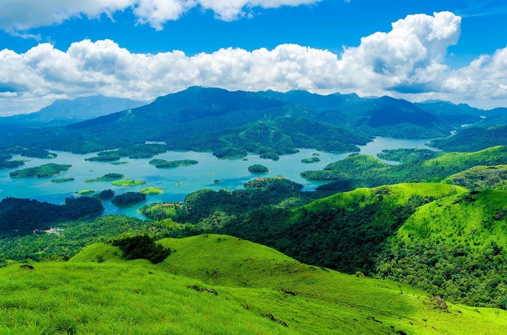
Banasura hill is the second tallest mountain in the Wayanad district. It is situated at a height of 2030 meters and 6660 feet above sea level which is one of the highest peaks in Kerala. The Banasura narrow hill trek to the peak passes through lush green hills with, thick forests, steep rocky terrain, plain and rolling grasslands-splendid shola forests. The hill is home to several medicinal plants and various animals like monkeys, elephants, deer, and wild boar, etc, who are often seen on the trekking trails. The Banasura trek trail is a continuous uphill trail with some rising and falling segments.
The Trek to the peak is 9 Kms long and can be trekked in 4 to 5 hours. Before trekking, Banasura Hill permission from North Wayanad Divisional Forest Office located at Mananthavady 25 Kms away is to be obtained. It can be easily accessed from Padinjarethara situated at a distance of 18 km from Kalpetta. The Banasura Peak offers a splendid view of landscape stretched in all directions and the Banasura Lake floating below.
It is recommended to trek Banasura Peak during winter; however, the best time is Between September to January. During monsoon the trek becomes slippery and the weather is too humid during summer. The nearest Railway Station and Airport is Calicut 79 and 92 Kms far respectively.
Kerala is a beautiful state that you should definitely visit as it has many beautiful places other than peaks. So do not wait any longer a plan a trip to Kerala now!
Leave a Reply